Drone mapping large wetlands
Flightworks are authorised by CAA to fly drones further than visual line of sight (in restricted circumstances). This means we can efficiently cover large areas without having to move flight bases and our drones can access distant areas of interest.
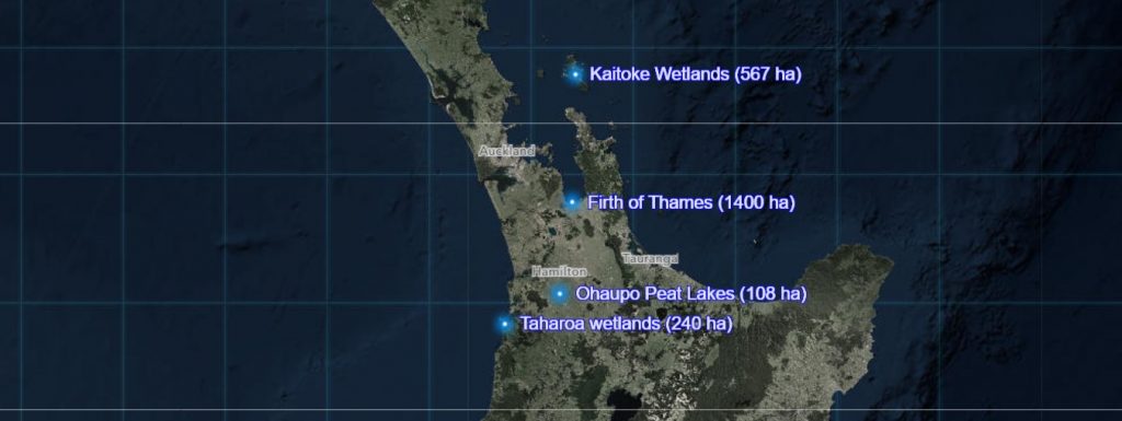
ArcGIS Storymaps are a great way to present data and provide valuable insights into natural area management. In the Storymap link below are 4 examples of our recent work in large and inaccessible wetlands:
Firth of Thames mangroves (1,400ha)
The Department of Conservation is searching for the weedy grass spartina in the large area of mangroves in the Firth of Thames.
“Flightworks provided high resolution imagery over a very large area. We can use this imagery on smartphones when checking and controlling weeds in the field, while having live access to our database”
Ken Brown, Conservation Services Ranger (Biodiversity), DOC Hauraki
Ohaupo Peat Lakes (108ha)
The Living Water partnership between Fonterra and the Department of Conservation is helping manage the peat lakes in the Ohaupo area, south of Hamilton.
“Storymaps are a great way to visualise a wide range of data in one easy format and an excellent tool to track progress and share project outcomes with management, stakeholders or project sponsors.”
Dion Patterson, Senior Ranger Operations, DOC Waikato
Taharoa wetlands (240ha)
Waikato Regional Council and the Department of Conservation are collaborating with the Taharoa Lakes Trust to manage the many wetlands surrounding the Taharoa Lakes, south of Kawhia Harbour.
“Flightworks used drones to help us detect and map weeds in a complicated network of remote wetlands.”
Thomas Emmitt, Supervisor, Biodiversity, DOC Maniapoto
Kaitoke wetlands (567ha)
The Department of Conservation and Auckland Council are managing weeds in the DOC Kaitoke wetland and surrounding private wetlands at Claris, Great Barrier Island.
“We use ArcGIS Online Storymaps to deliver aerial drone data in smart ways to help manage and communicate projects.”
Scott Sambell, GIS Manager, Flightworks
Click the image below to open the Storymap about these wetlands:

